Mosaic anchor point definition
The anchor mosaic point is used to define the starting point of the mosaic. It is also used as reference point for the naming of tiles.
There are two ways to define this point:
Defined point
You can directly enter the coordinates of the anchor point using kilometers values. Click on the "Defined point" radio button and type the two values in the "X" and "Y" text fields. The grid is recalculated according to these new coordinates.
The use of a defined point permits to establish the anchor point. Its coordinates will not change even if the size of the mosaic is modified.
Example :
|
|
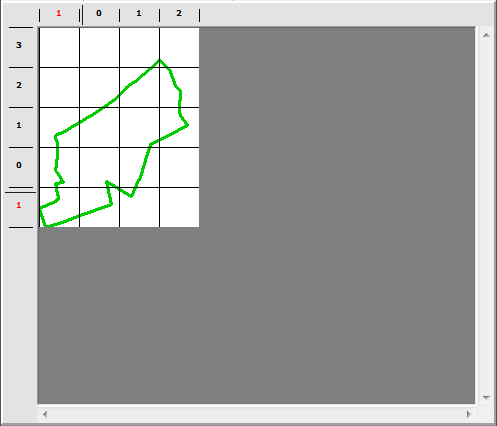
The file contains an extraction. The size is defined as automatic and the anchor point is defined as a "Defined point".
|
|
|
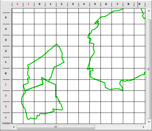
If we add a second extraction the grid is recalculated. But the first tiles don't move because the anchor point is defined as a "Defined point".
|
Anchor point using the size of the mosaic
You can also use one of the five points which correspond to the four corners and the center of the mosaic limit. But if you modify the size of the mosaic, the coordinates of the anchor point will also be modified. It can be embarrassing if you generate several mosaics of different sizes from one single file because the overlay parts will not be adjusted.
Example :
|
|
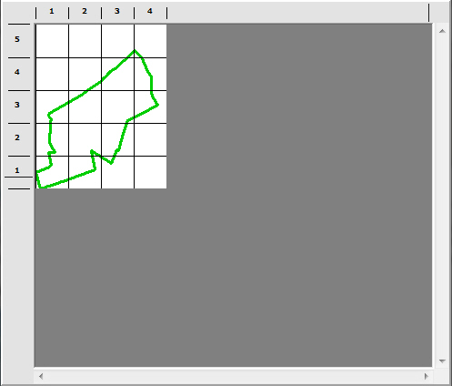
The file contains an extraction. The mosaic size is defined as automatic and the anchor point as "Bottom left corner"..
|
|
|
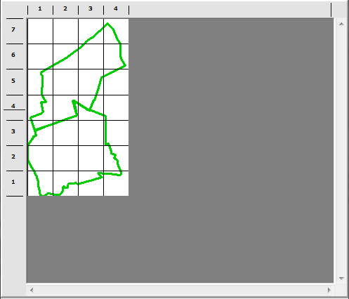
If we add a second extraction the grid is recalculated. But the tiles have moved and there will be no possible overlay with the mosaic generated from the previous version of this file.
|